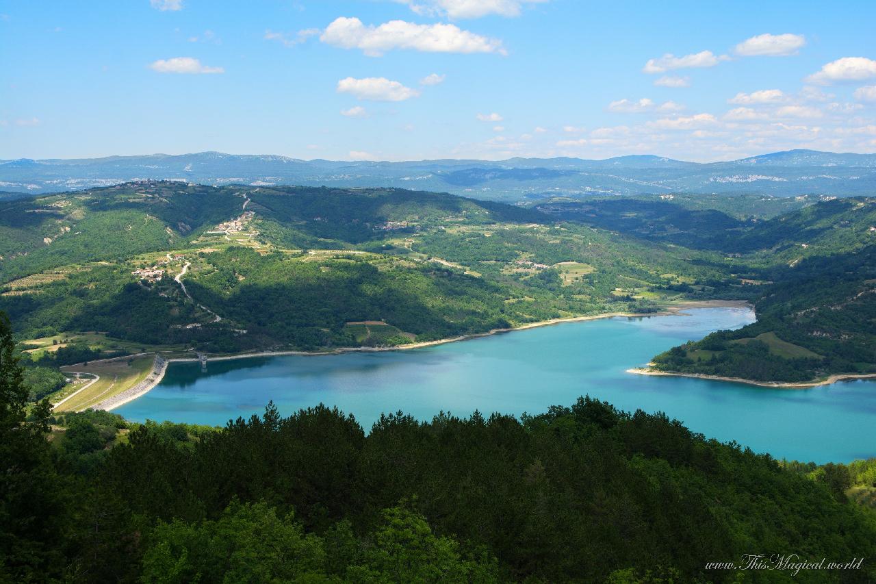
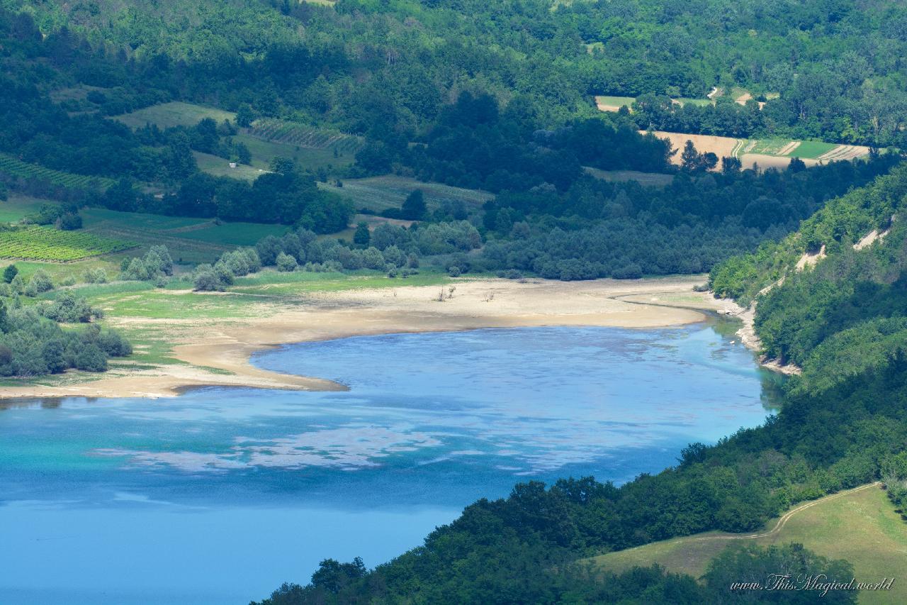
If you are ever going to find yourself in the Croatian part of Istria, consider going to this location: 45.3163692N, 13.9120325E. At the time of writing this article, this spot is not marked on Google Maps. What you will find at the above-mentioned location is a stunning view of the lake Butoniga. However, getting there might not be the easiest thing in the world, as the road is narrow, and the climb is very steep.
Lake Butoniga is the largest lake in Istria. The lake is artificial and has been created in 1988. The main tributaries of the lake are Grdoselski, Dragućki and Račićki streams. Its main purpose is water supply and irrigation. The lake itself is not accessible for tourists, and swimming and fishing in the lake are prohibited.
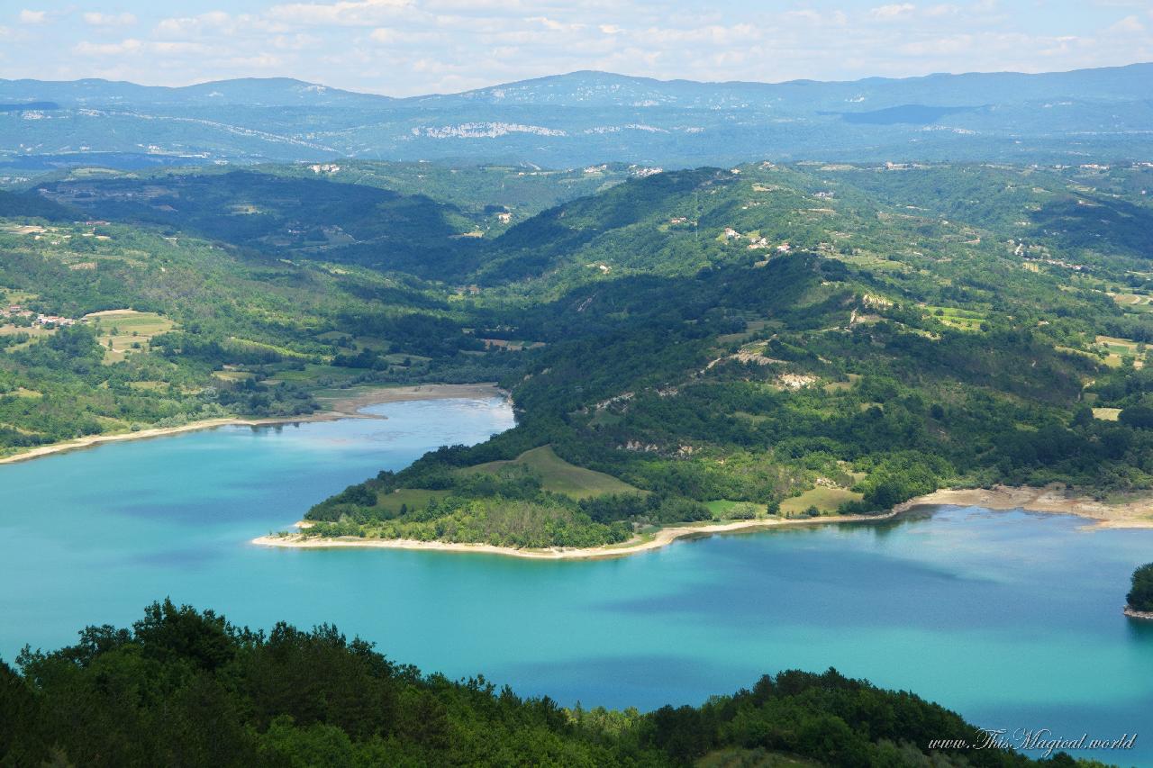
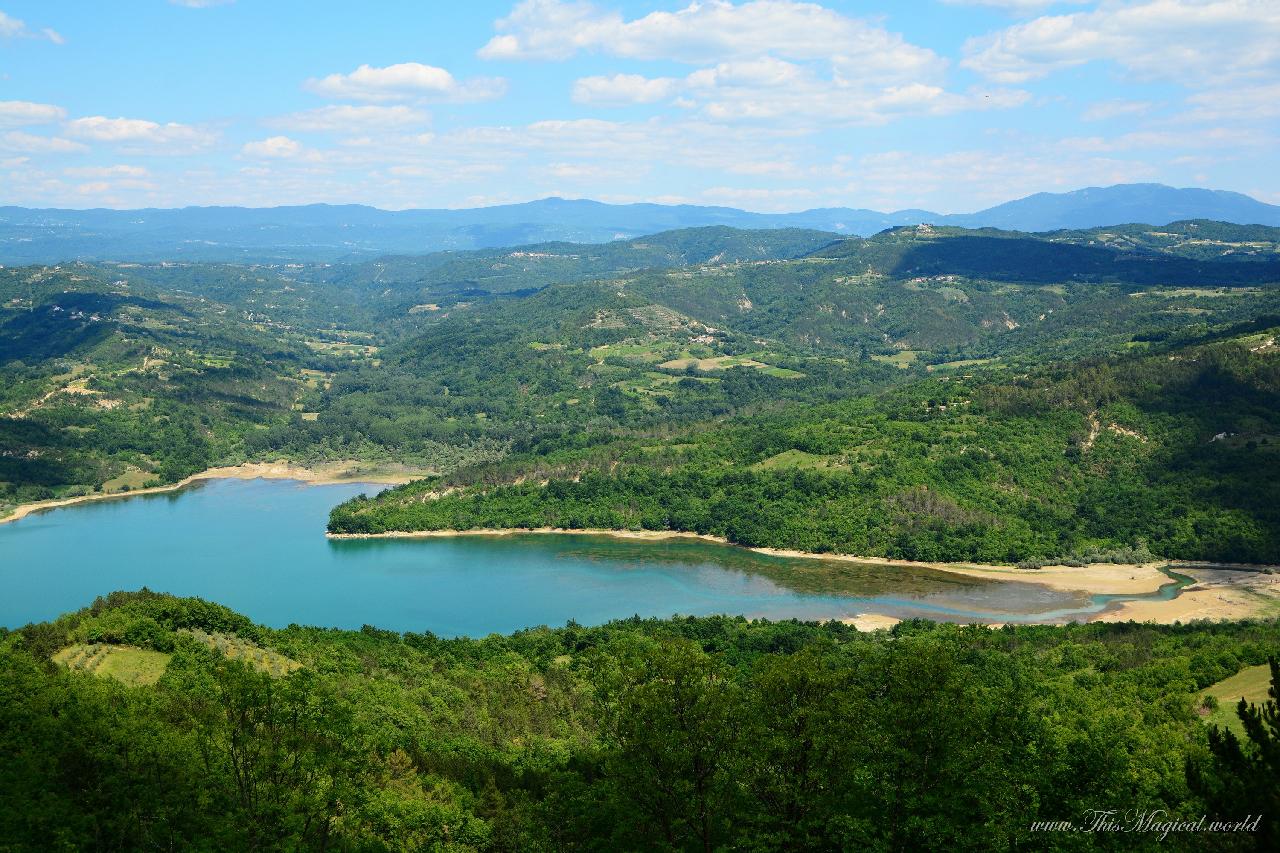
From the viewpoint you will see the entire lake, whose surface is 2.45 sq.km. Getting there with binoculars or a telephoto lens might be a good idea, as there are certainly many things to look at. In the summertime the lake is frequented by various birds. You can see numerous villages and mountains in the distance.
I was wondering, how many different photos will I be able to take from this one spot. And it turned out, quite a lot. Fitting a lake into one photo didn’t feel right, as there were so many details. And as the clouds were passing and creating all kinds of shadows that were changing every few minutes, one spot never looked the same.

Using a telephoto lens with a focal length set to 500 mm I took a lovely picture of a hilltop village which is located 5 km away. The village is called Vrh, which literally means ‘top’.
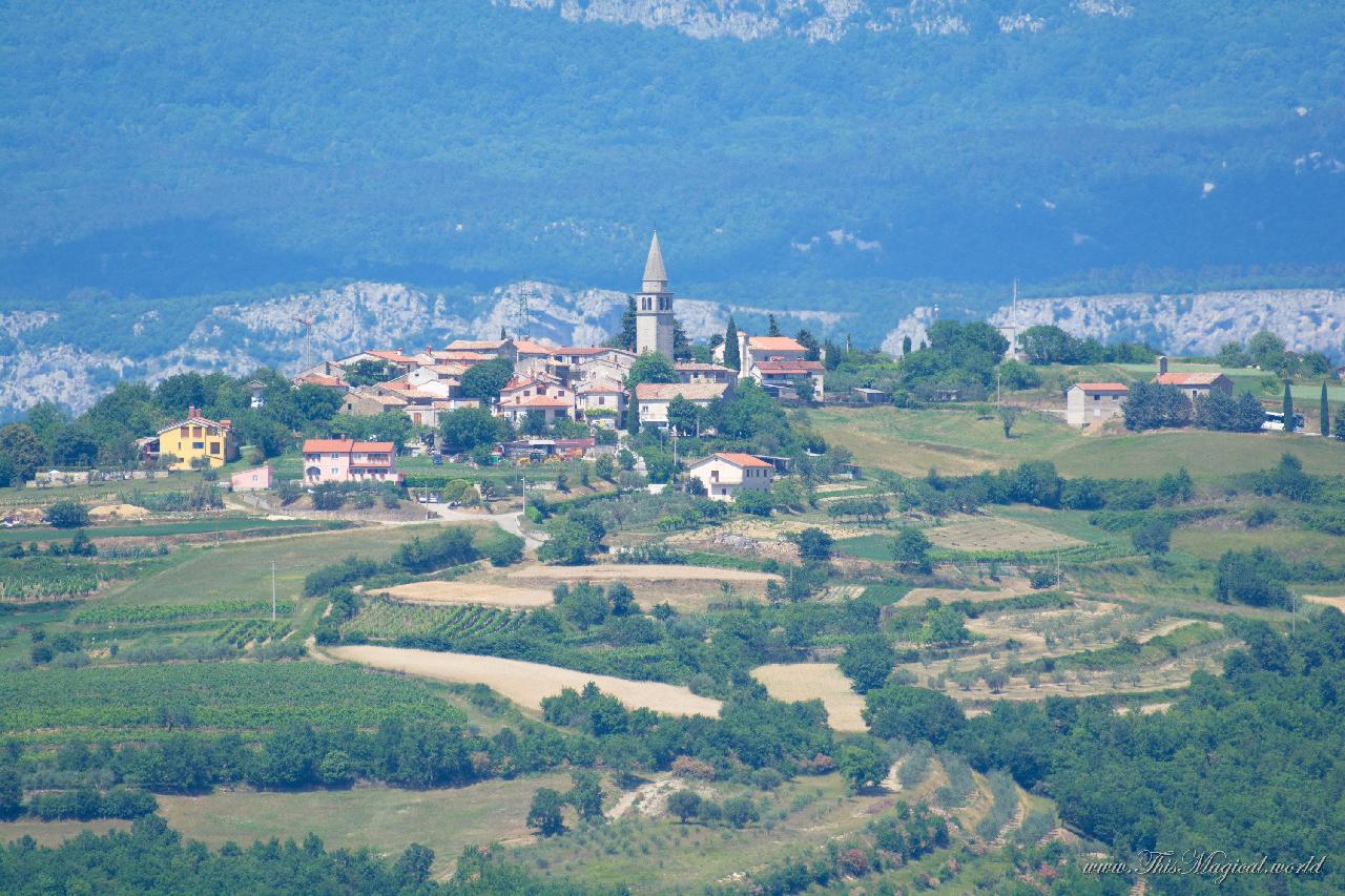 Vrh village near lake Butoniga
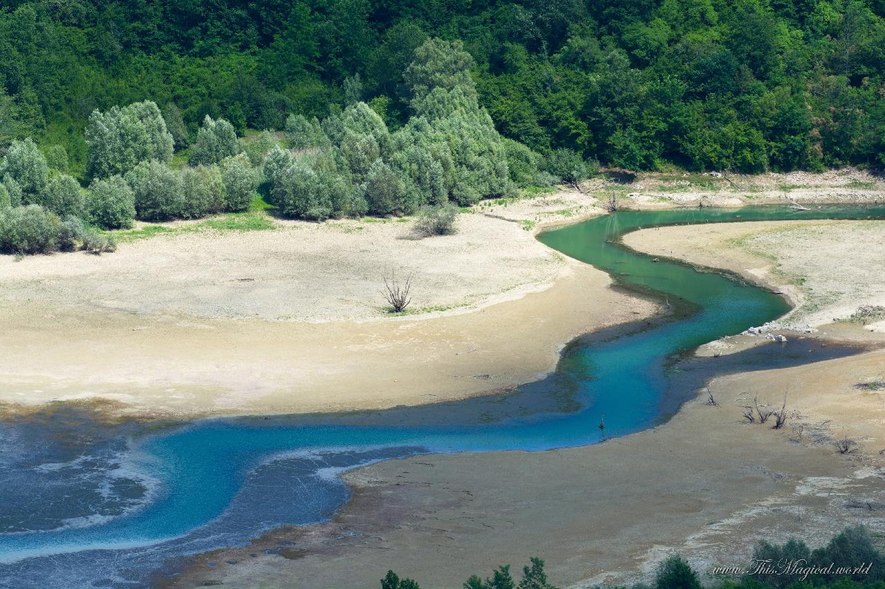
Two larger streams that flow into the lake are visible from the viewpoint. The one on the left is called Račićki stream, the one on the right end of the lake is called Grdoselski stream.
Zooming in on the Račićki stream produces a picture that looks almost as if it has been taken on a different planet. Grdoselski stream also isn’t far behind in producing a spectacular landscape.
 Lake Butoniga and Račićki stream
 Grdoselski stream
Next, I drove some 20 km to a village called Butoniga. Grdoselski stream flows nearby, and here a relatively small waterfall called Veli slap is to be found. This is one of the very few waterfalls in Istria that aren’t completely dried out during the summer. These are the coordinates of the waterfall: 45.2914133N, 13.9623128E.
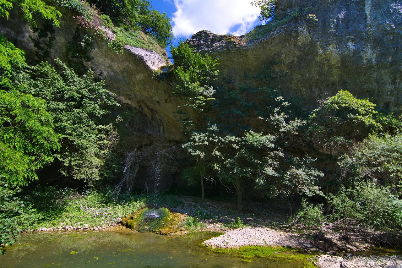 Veli Slap on Grdoselski stream, Butoniga